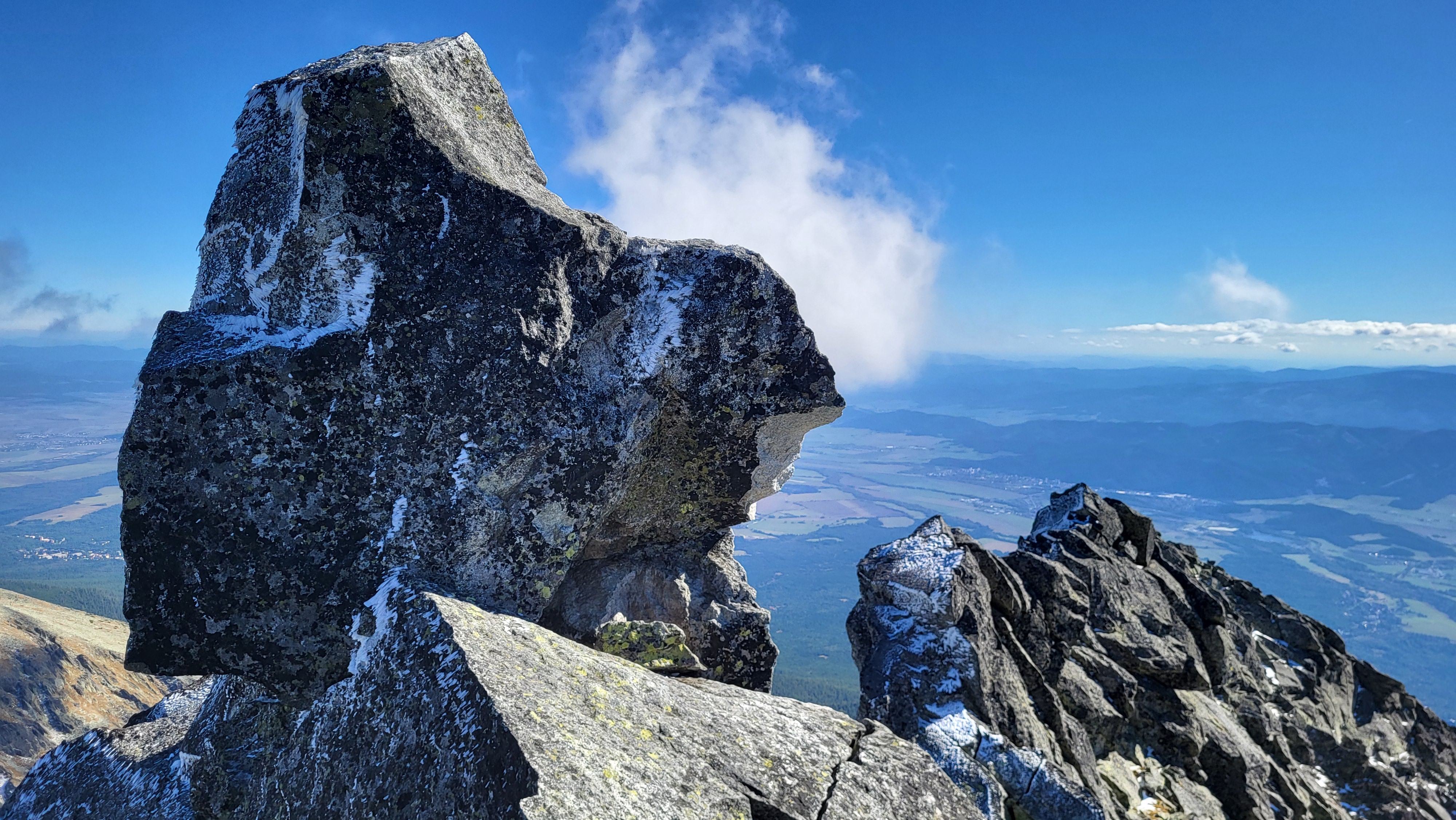
Končistá is located on a ridge that branches off southward from the main ridge of the High Tatras, starting at Popradský Ľadový štít. It is the last and highest peak of this ridge. It has two summits – northern and southern. On the southern summit is an iconic boulder known as Jármayho stôl or Nákova (The Anvil), part of which broke off into the gully below the summit after a lightning strike in 2019. Its ridge separates the Batizovská and Štôlska valleys.
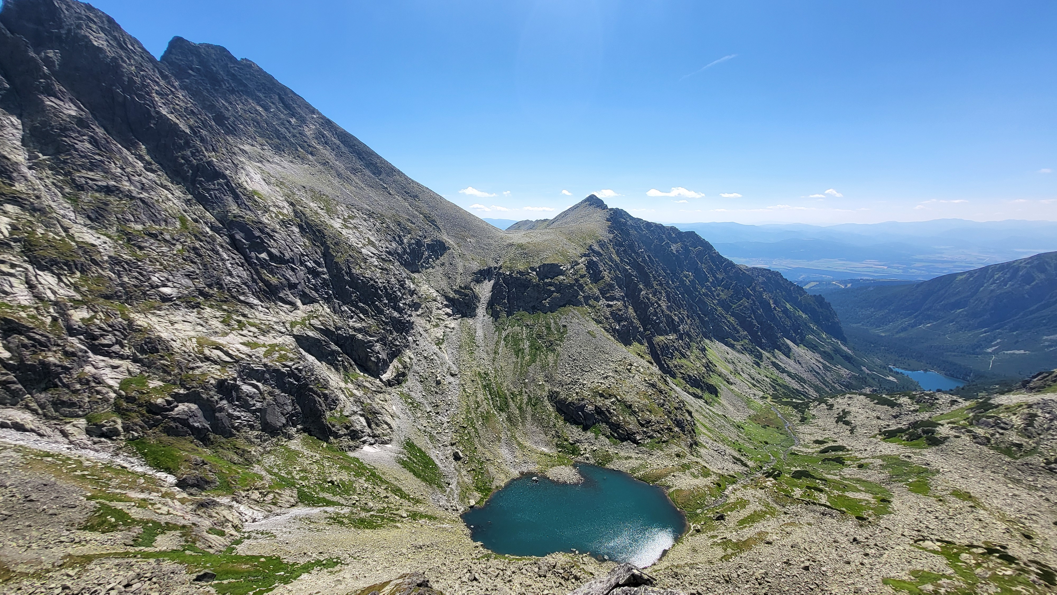
The ascent to Končistá is particularly attractive because of the panoramic views – of the central ridge of the High Tatras with peaks such as Vysoká and Rysy, the Gerlachovský štít ridge above Batizovská dolina, the Podtatranská basin, and the Low Tatras ridge.
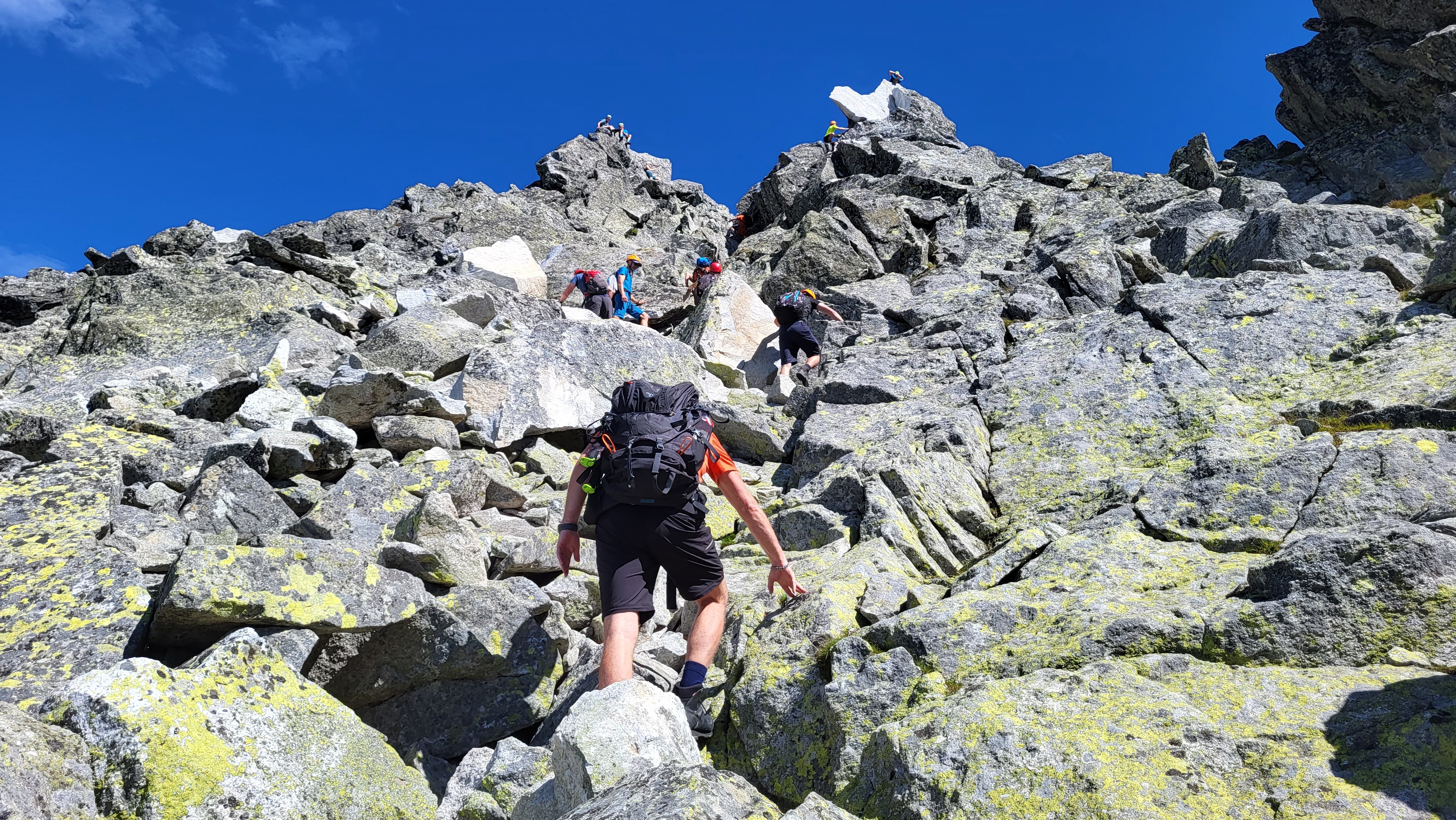
The hike begins at Popradské pleso. Following the Tatranská magistrála (red-marked trail), we reach the Sedlo pod Ostrvou. From there, we continue on an unmarked trail to Tupá (2284m). From Tupá, we descend slightly into the wide Lúčny sedlo, and then climb a steep slope to reach the summit of Končistá (2537m).
This is a moderately difficult hike, intended for fit hikers in good physical condition with mountain experience, as most of the route is off marked trails.